Highlight assortments, select route or area, mark nature sites
New features assist machine operators and improve productivity.
• Highlighting the assortments. The different timber assortments can be highlighted with different colors by marking them as favourites. This helps the operator to separate the assortments in the load space and to build the load so that it is already sorted. This speeds up the unloading considerably. With the help of sorters that are available for the load space, unloading mixed loads is easy and productivity is vastly improved.
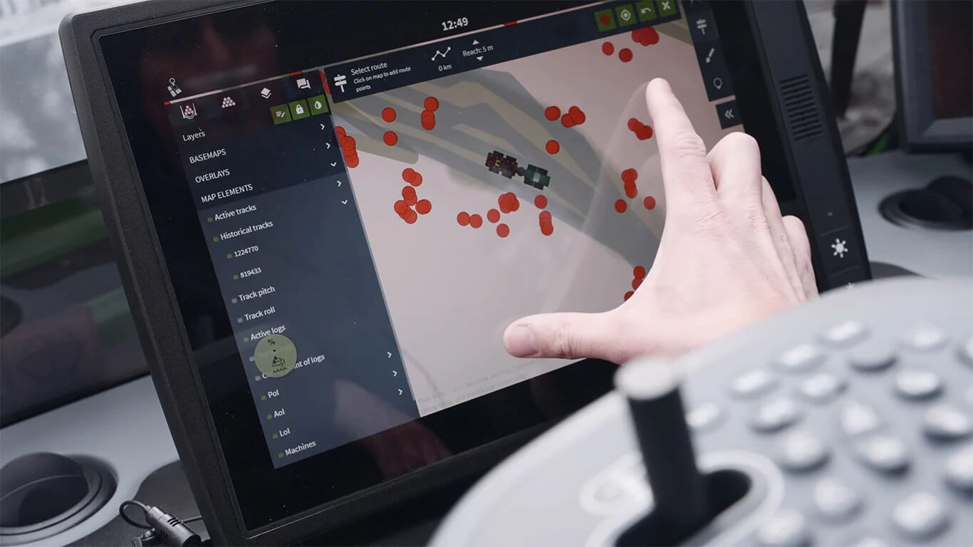
• Route selection. You can choose a 10 m wide route with the route selection tool. It is now also possible to make a narrower route selection.
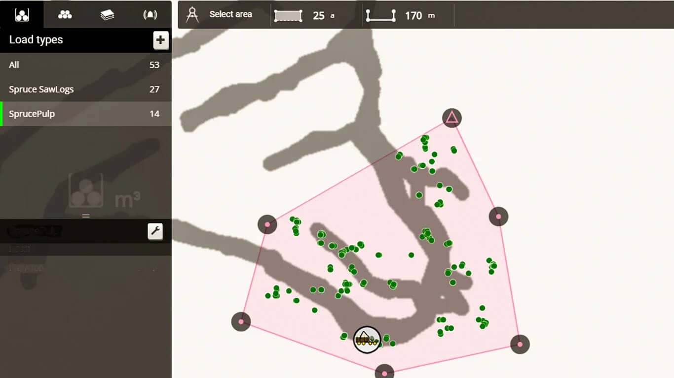
• Selection tool. With the selection tool you can select areas of different sizes. The distance from the hand-icon can be expanded or narrowed and you can edit the area with the eraser tool. You can even record the driving route and fix it with the eraser if you accidentally included extra logs.
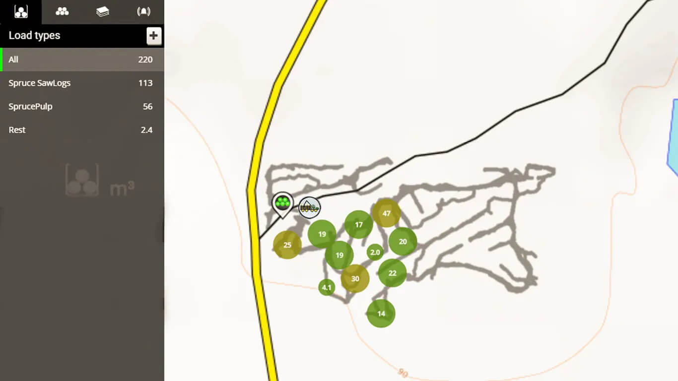
• Collect and upload directly. You can collect and directly upload the logs in the system, and easily see the amounts of different timber assortments. Even the inventory history is memorized.
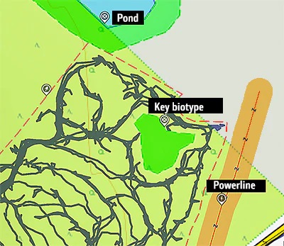
• Avoiding ecologically sensitive or dangerous areas. If the logging site has some noteworthy areas, like a pond, a steep slope, a spring, a brook or perhaps a power line, the harvester operators can mark it on the map with a comment. If needed, they can add an alert to the comment; this way, the forwarder operator is notified when approaching the area.
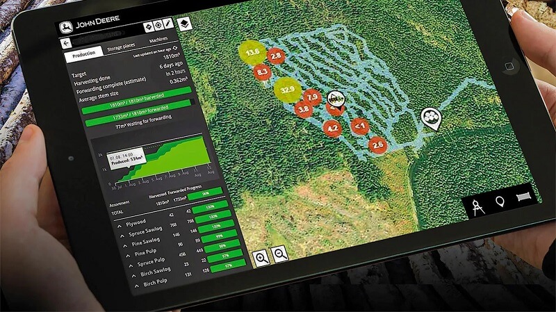
TimberMatic Maps is a new way of visualizing a logging site. The application clarifies and improves the teamwork of the machines. The operators and contractor have a real-time view to the progress of the work site.
The operator marks the forwarded timber as transported to the storage area. The operator of the next shift knows where to start their work. There is no need for an estimate of the volume and not a single log will be left even in a dark forest, for different assortments are shown on the map right down to the single log even if they are covered by snow.

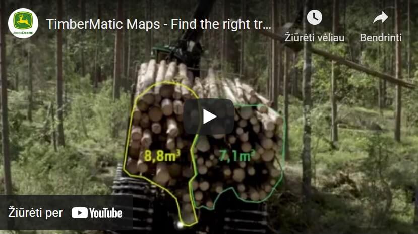
Forwarder operator can choose the desired assortment from a specific area or along a logging route and the map will show the exact volume of that assortment in the chosen area. The operators can also mark special areas on the map. This way e. g. soft ground can be avoided when planning the driving route.
The map shows all the assortments down to the single log with the logging route network. Planning the work and the best driving route will be very simple.
Starting the logging site
Starting the logging site and creating the landing area on the map.

Progress of the site
Progress of the logging site shows in real time on the map
Route selection
Route selection and timber to the landing area

Sharing information
Sharing additional information about the site

Hardware and software requirements
Hardware
TimberMatic Maps requires the following hardware
- 4G MTG
- harvesters: HPC15 (XL4)
- forwarders: HPC15 (XL4) or PC (XM2+)
PC (XM2+) has been in serial production from September 2018.
HPC15 (XL4) option is recommended if forest industry software is used in a forwarder.
4G MTG has been in serial production from September 2018.
For updating your 3G MTG to 4G MTG, ask your dealer about the options and prices.
Software
TimberMatic Maps requires TimberMatic version 2.0 or newer.
TimberMatic Maps can also be downloaded as a separate software installation package. Ask your dealer for more information.
TimberMatic Maps doesn't work in CTL forest machines with CommandCenter, XM2 PC or older PC with Win XP (HPC07, HPC11 or XMPC).
 INTRAC Lietuva
 INTRAC Lietuva